

![]()
The East Coast Trail Guide is a digital trail guide and photo book filled with information about Newfoundland’s amazing East Coast Trail, including Sugarloaf Path.
A free sample of Newfoundland’s #1 hiking guide is available on Apple Books.
Don’t have Apple Books? There’s lots of trail information on this blog too. Below you’ll find a basic map, a quick trail description, and trail stories and photos from hikes in every season:
Basic map:
Trail description:
Sugarloaf Path runs from Logy Bay to Quidi Vidi.
Check the map for the following details:
- The trail is 8.9 km in length.
- The north trailhead is at the Ocean Sciences Centre in Logy Bay.
- The south trailhead is at the end of Cadet Road in Quidi Vidi.
- Check the map for designated parking areas.
- Bing Maps used to offer a unique aerial perspective of Sugarloaf Path.
This is a straightforward hike without significant challenges, save perhaps for the initial uphill slog near both the north and south trailheads. A huge whale tail sculpture marks the start of the hike in Logy Bay and indeed it’s a good place to watch whales in summer, just like Cobbler Path on the other side of the bay.
Starting the trail uphill from the Ocean Sciences Centre you’ll soon find yourself on top of Sugarloaf Head, a barren hill with an imposing view in all directions. From up there you can see that further on, the trail inches by the huge Robin Hood Bay landfill, a fact that may possibly elude you when you actually pass it. Depending on the wind direction, you are sure to notice the noise and smell though.
After the landfill and Small Point you’ll arrive at the Rags on Skerries Bight, which for me serve as a natural resting point on the trail. After that it’s a basic climb up Bawdens Highland and you’re almost at the end of the trail; take a deep breath, then enjoy the fantastic view of Quidi Vidi harbour and Cuckold Head on your way down.
Trail flyer:
![]()
Do you offer accommodation in this area? Here’s a trail flyer you can use to promote the trail. Flyers about other parts of the East Coast Trail can be found on the trail flyers page.
Scenic spots on Sugarloaf Path:
- The Ocean Sciences Centre, which looks like something straight out of a science fiction movie.
- Sugarloaf Head is the place to be for a view spanning from Red Cliff to Cape Spear and beyond.
- The Rags are an interesting place to have your lunch with a view of the waves rolling in, keep a look out for seals.
- Bawdens Highland has a great view of Quidi Vidi.
Berry picking:
Berries you can find on Sugarloaf Path include blueberries, cranberries and partridgeberries.
Featured stories on Sugarloaf Path:

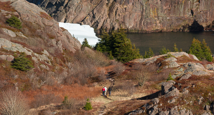


More photos and stories on Sugarloaf Path:
- Eagle & iceberg - June 2016
- Snow squall on Sugarloaf Path - January 2016
- Winter 2014, so far - February 2014
- Snowy White Hills in Quidi Vidi - January 2014
- Summer busy - July 2013
- Mushrooms on Bawdens Highland - August 2012
- Foggy icebergs - April 2012
- Quidi Vidi icebergs - April 2012
- Iceberg climbers in Quidi Vidi - April 2012
- Icebergs on Sugarloaf Path - April 2012
- Stuck inside the house - April 2012
- Gull caught on a bag - February 2012
- Raven below Sugarloaf Head - November 2011
- First day of summer, so much fog - June 2011
- Sugarloaf Path on Bing Maps - May 2011
- The Plastic Forest - May 2011
- Foggy Monday hike - January 2011
- Otter show in Quidi Vidi - November 2010
- Fall hike on Sugarloaf Path - October 2010
- Killer whale movie - August 2010
- A night on the Sugarloaf - April 2010
- Shallow Fog - April 2010
- White Hills trail in Quidi Vidi - January 2010
- Sugarloaf & Big River trail - April 2009
- Ocean Sciences Centre Panorama - April 2009
- Using my new tripod - February 2009
- Sugarloaf Head with Marije - January 2009
- Thank you for keeping in touch - January 2009
- First hikes on the East Coast Trail - December 2008
